Sometimes a map can say what a thousand words cannot.
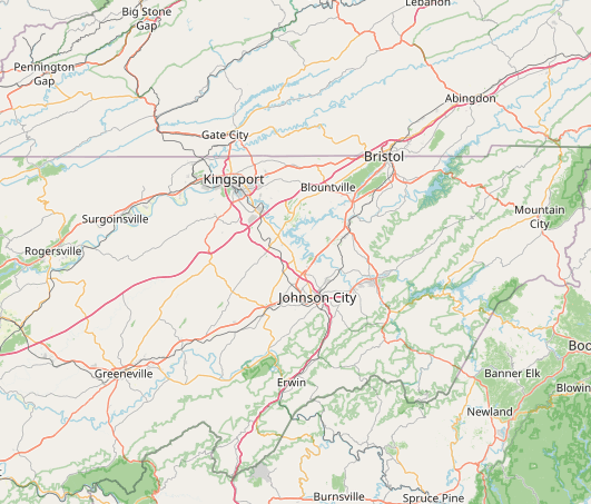
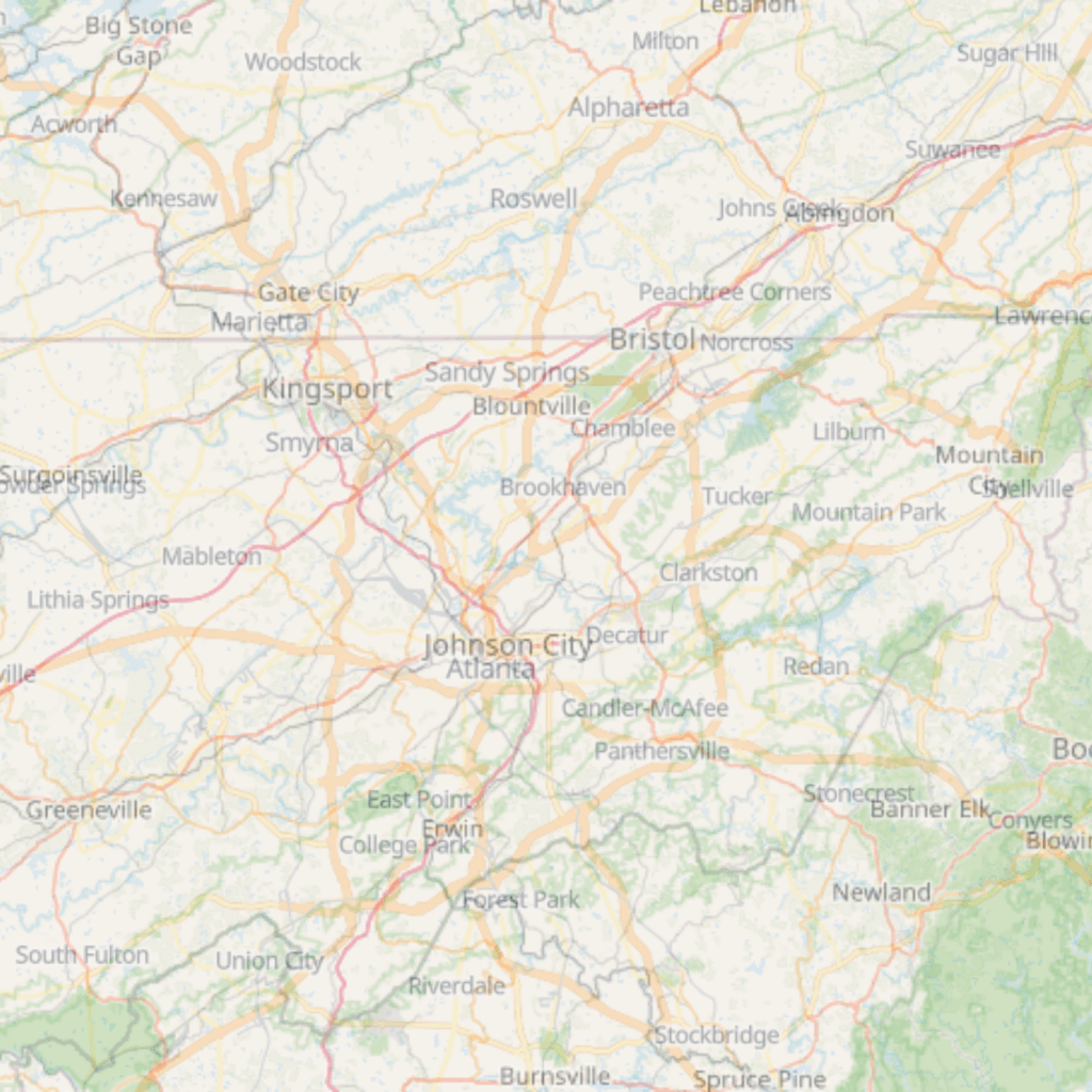
For example, I recently created a map superimposing Atlanta onto the Tri-Cities, TN+VA region.
It takes the familiar geography of Johnson City, Kingsport, Bristol, Greeneville, Elizabethton, Abingdon, Blountville, Jonesborough, and the surrounding communities and places it over a region most people already understand as a single connected metropolitan area.
And suddenly, the distances feel different.
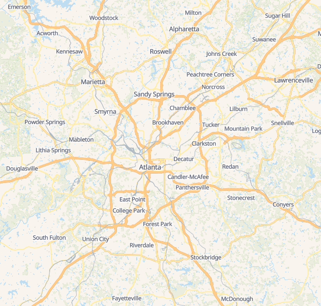
In Atlanta, one of the clearest ways people understand the region is through I-285 — “the Perimeter.” Inside the Perimeter is the urban core. Outside the Perimeter are still communities that are unmistakably part of metro Atlanta. They may have their own governments, histories, downtowns, schools, shopping areas, and civic pride, but nobody thinks Atlanta begins and ends at downtown.
That is the perspective this map gives the Tri-Cities.
If Johnson City (TN) were downtown Atlanta, then:
Kingsport (TN) would sit at the northwest Perimeter near Truist Park (Braves Stadium) at the I-75 North interchange.
Bristol (TN+VA), would fall at the northeast Perimeter, much like Norcross at the I-85 North interchange.
Blountville (TN) would sit at the north Perimeter like Sandy Springs at the GA 400 interchange.
Gate City (VA) would be near Marietta on I-75 North.
Big Stone Gap (VA) would be near Acworth and Lake Allatoona on I-75 North.
Nickelsville (VA) would be near on GA 400 North.
Lebanon (VA) would be just past Alpharetta, near Milton, on GA 400 North.
Jonesborough (TN) would fall on the western Perimeter at the I-20 interchange.
Elizabethton (TN) would be inside the Perimeter, more like Decatur.
Abingdon (VA) would sit farther out, more like Johns Creek — a strong destination community with a clear identity, high quality of life, and a draw that reaches well beyond its own town limits.
Greeneville (TN) would be more like Douglasville on I-20 West — a larger outer community with history, industry, neighborhoods, and a role in the broader regional economy.
And Erwin (TN), in this comparison, would sit on the southern Perimeter near Hartsfield-Jackson International Airport.
Essentially, the Atlanta North Metro would be in Virginia, while the rest would be Tennessee.
The 285 comparison helps because it changes how we see distance.
In Atlanta, driving from downtown to Truist Park does not feel like leaving the region. Driving from downtown to Norcross does not feel like entering another world. Driving from Sandy Springs to the airport is normal metropolitan movement. People understand the region as a network of centers, corridors, employment hubs, neighborhoods, historic towns, and destinations.
Now apply that same lens here.
Johnson City, Kingsport, Bristol, Greeneville, Elizabethton, Abingdon, Blountville, Jonesborough, and the communities between them are not isolated dots competing for oxygen. They are pieces of one regional system.
We already live this way.
People may live in Kingsport, work in Johnson City, fly out of Blountville, visit Jonesborough, shop in Bristol, hike near Elizabethton, spend a weekend in Abingdon, and have family in Greeneville. They may go to church in one city, see a doctor in another, attend a ballgame in another, and meet friends for dinner somewhere else.
That is not unusual.
That is metropolitan life.
The problem is that we do not always think, market, plan, or advocate at that scale.
When companies look for talent, they look at regions. When visitors plan trips, they look at regions. When hospitals, colleges, industries, developers, and retirees make decisions, they look beyond city limits. They look at airports, workforce, housing, schools, health care, cultural amenities, recreation, quality of life, and overall accessibility.
A strong Kingsport helps Johnson City. A strong Johnson City helps Bristol. A strong Bristol helps Abingdon. A strong Jonesborough helps the regional heritage story. A strong Elizabethton strengthens the outdoor and river story. A strong Blountville helps everyone.
We are partners.
The Kingsport Spirit has always been rooted in community pride, mutual helpfulness, and a willingness to place the greater good above narrow interests. That kind of local pride does not leave less room for regional pride. It creates more. It reminds us that loving Kingsport and working with our neighbors are not competing ideas. They are two sides of the same commitment to making this whole place stronger.
This map reminds us that what feels far apart in Northeast Tennessee and Southwest Virginia would feel normal in Atlanta. What we sometimes describe as separate cities would be understood elsewhere as a connected metropolitan area with multiple centers.
Maybe the Tri-Cities does not have a literal I-285 beltway.
But we do have a regional perimeter of our own — formed by I-26, I-81, U.S. 11W, U.S. 19E, U.S. 23, the Holston and Watauga valleys, and the communities that have grown together over time.
The question is whether we will keep seeing ourselves as separate places merely sharing a map, or whether we will see ourselves as what we already are:
A region.
A connected economy.
A shared story.
A place large enough to count, close enough to function together, and distinctive enough for every community to keep its own identity.

Leave a reply to Sandy Vowell Cancel reply