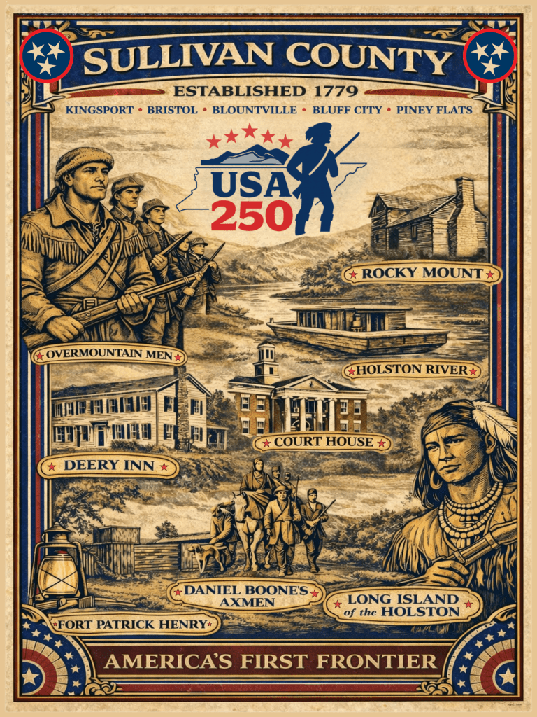
Fifth in a 12-part monthly series to commemorate Sullivan County’s role in the 250th birthday of the United States of America
May 2026 | 5 of 12
Rivers functioned much like an early version of our modern interstate system, especially when they were navigable. Long Island (later King’s Port) in Sullivan County was considered the head of navigation for the Tennessee River system. It was a launching point for downstream exploration and settlement.
Above Long Island, the geography changes dramatically. The Holston River cuts through the ridge-and-valley landscape, exposing high bluffs still visible today at Warriors’ Path State Park. After its final bend near today’s Fort Patrick Henry Dam, the river opens into a wide, flat valley at the foot of Bays Mountain. Opposite Long Island, it became known as the Island Flats, located at the terminus of Island Road.
Downstream into Hawkins County, the Holston became a series of broad, fertile bends that supported settlement but also carried danger. Before the Tennessee Valley Authority, seasonal flooding was part of life along the river. We have grown somewhat desensitized to that risk. For early settlers, the same river that served as a lifeline could also become a death sentence. In 1830, “river fever” — cholera — swept through families such as the McPeeters, Seawrights, and Currys, erasing names from the pioneer record almost overnight.
The river corridor connected diplomacy, migration, and expansion. In March 1775, the Treaty of Sycamore Shoals (now Elizabethton) on the Watauga resulted in the Transylvania Purchase. Through that agreement, Cherokee leaders consented to a vast land transaction that included much of present-day Kentucky and addressed access across the Appalachian frontier.
With that agreement in place, Daniel Boone and a party of axmen began cutting what became known as the Wilderness Road on March 10, 1775, starting from Long Island of the Holston and pushing toward the Cumberland Gap and Kentucky. Boone’s presence underscores a larger point: the Holston corridor was never merely local. It was a launch point for continental expansion.
Two years later, in the summer of 1777, negotiations at Long Island culminated in the Treaty of Long Island of Holston, often called Avery’s Treaty. It did not end frontier tension, but it did establish terms that brought a period of relative peace.
Then, in 1779, the westward story of Tennessee took another consequential turn. James Robertson led an overland party from the Holston settlements toward the French Lick on the Cumberland River. He followed the trail blazed by Daniel Boone through Cumberland Gap. John Donelson soon followed by water, leading a flotilla down the Holston & Tennessee, to the Ohio & Cumberland rivers. They met at the site of modern Nashville.
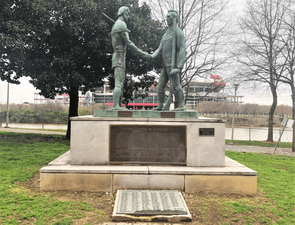
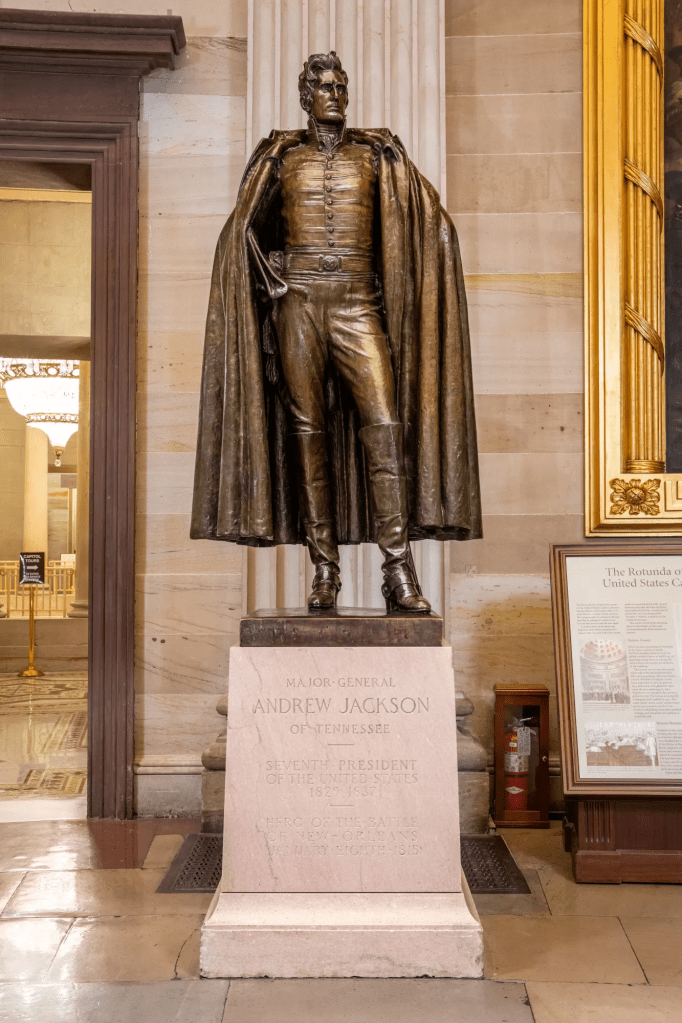
That journey reaches into national history through Andrew Jackson, who later came to Tennessee as a young lawyer, settled in the Nashville area, and married Rachel Donelson, John Donelson’s daughter. In that sense, the movement from Long Island helped shape not only Middle Tennessee but also the circumstances that produced one of America’s most consequential presidents. During Jackson’s presidency, the route reversed as he passed through Kingsport on his way from Nashville to Washington.
By 1780, another Sullivan County crossing gained prominence. Choate’s Ford, at present-day Bluff City, is well documented as the place where Overmountain forces crossed the Holston while moving from Abingdon toward Sycamore Shoals on their way to King’s Mountain — a battle many historians consider a turning point in the Revolution.
Sullivan County’s role is straightforward: the Holston Valley was a gateway. Crossings focused travel. Treaties shaped migration. The river carried people west and downstream.
As America approaches its 250th anniversary, it is worth remembering that the route to Nashville — and to Tennessee itself — ran through the Holston first.
Next in the series: June 2026 | 6 of 12 — 1780: When the War Passed Through Sullivan County

Leave a comment