My first recollection of the term “super-highway” was in reference to Stone Drive in the early 1960s. But did you know that Kingsport’s first “super-highway” was built at least 20 years earlier?
Kingsport was incorporated in 1917 as a compact, walkable town. The founders wanted to create a model city with a variety of housing options for working families. What motivated them? As native New Yorkers, they witnessed first-hand the overcrowded, unsanitary living conditions that led to the nation’s first zoning ordinance in 1916.
The founders followed the concepts of two major movements in city planning: “Garden City” and “City Beautiful“, which introduced curvilinear streets with triangles, circles, and pie-shaped intersections that looked nice on paper but underestimated the growing popularity of private automobiles.
Also in 1917 (in Chicago), I found the first newspaper reference to a “super-highway” system being planned – a road network specifically designed for cars to move rapidly across town.
It was a blind spot for Kingsport’s planners.
By 1929, 60% of families in the United States owned a car and government officials were scurrying to figure out how to build roads to accommodate them.
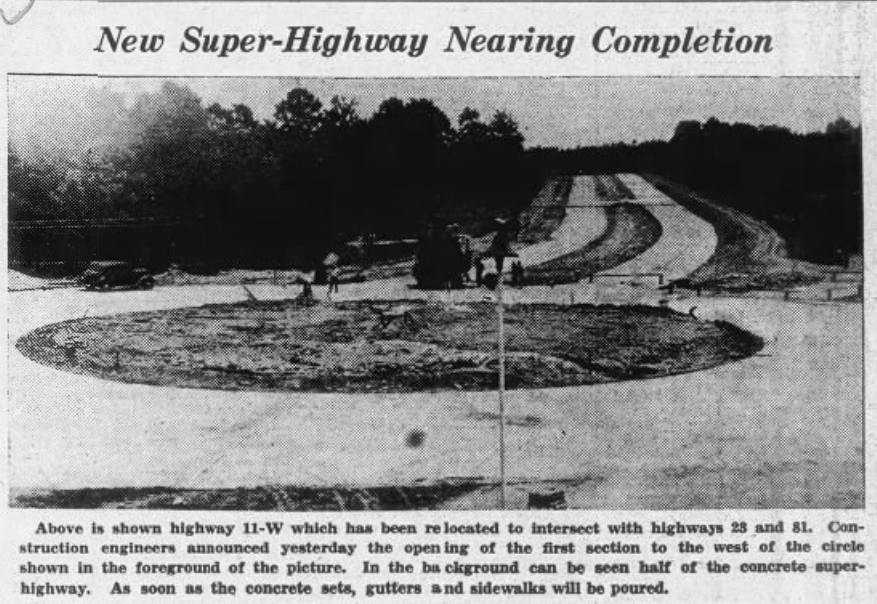
Originally, the route of U.S. 11W followed the “Lee Highway”, which was designed as an auto trail to connecting Washington, DC to San Diego. Locally, it followed the Bristol Highway (which we know as today’s East Center Street) from Downtown Kingsport through Highland Park. In those days, Highland Park wasn’t part of the city, it was an unincorporated village located 2 miles east.
The growth of Kingsport clogged Highland Park with traffic and a by-pass “super-highway” was sought. Remember, there was no Stone Drive, no John B. Dennis Highway, and certainly no interstate highway at the time. The only eastbound artery was the Bristol Highway.

The wide boulevard became the focal point of a grand civic space for parades, community gatherings, and today’s Fun Fest. The Civic Auditorium, J. Fred Johnson Stadium, Park & Memorial Gardens, and eventually the new Dobyns-Bennett High School sprung up along the route.
The convergence of 5-road segments (2 of which were divided boulevards) at Brooks Circle proved to a bad design for traffic circulation. Generations of Kingsport citizens had to pass their driver’s test by navigating Brooks Circle in order to receive their license, which was issued at the Tennessee Highway Patrol office located on the circle.
When the Fort Henry Mall was built in 1976, Memorial Boulevard was re-routed to eliminate the fifth leg. Today the remnant section is called Memorial Court.
And that’s the story of Kingsport’s very first “super-highway”–Memorial Boulevard (Highway 11W).

Leave a comment