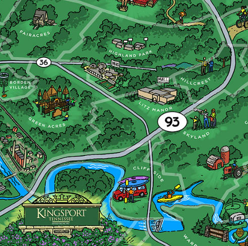
Kingsport is a tale of two cities — the original riverport incorporated in 1822 and the planned, model city incorporated in 1917. The two did not become one until 1963. The model city limits were originally confined to what is today Eastman Road on the east and Riverside Avenue on the west. The southern limit was the Holston River, and the northern limit was the ridge above Reedy Creek. The model city was surrounded by settlements that either pre-dated or evolved as a result.
I found the first reference to “Warpath, Tenn.” in the 1903 Chattanooga News. It mentioned that Mr. & Mrs. George Petty were visiting their son at Warpath, Tenn. I also found a George Petty on Ancestry.com that claimed a residence at both Bristol and Chattanooga in 1903. Then I found a reference in the 1910 Bristol Herald-Courier that Mrs. J.H. Bradley of Warpath, Tenn. was visiting her father, Mr. Leatherwood, or North Carolina.
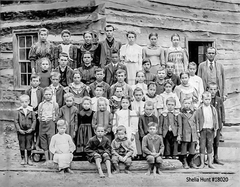
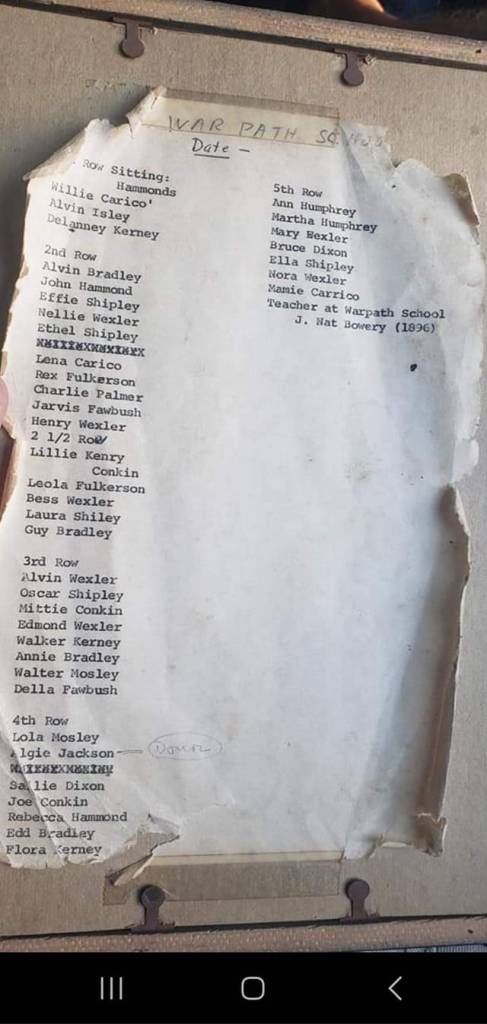
The community was large enough to support Warpath School, “one of the oldest institutions of its kind in Sullivan County”, which was destroyed by fire in 1935.
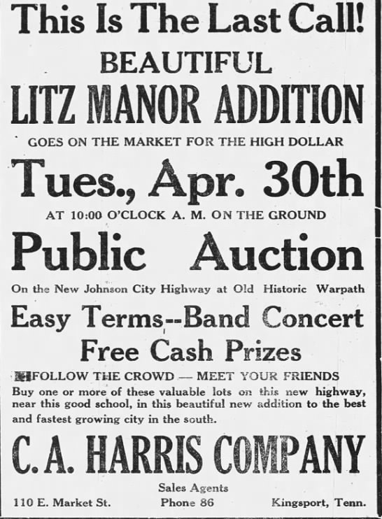
The 1929 announcement of Litz Manor addition “on the new Johnson City Highway at Old Historic Warpath” began the process of usurping the Warpath name.
According to longtime Sullivan County archivist, Shelia Steele Hunt, the school was located at the intersection of today’s Warpath Drive and Konnarock Road.
A replacement school, called Litz Manor, was the subject of a 1937 bond referendum. It was built a little farther south on Bruce Street but closed after annexation in the mid-1950s. It was later razed and redeveloped for housing in 1959. Today it is Lawndale Circle and Wooddale Circle.

It makes sense that the name Warpath would pre-date Kingsport. According to the Battle of Island Flats historical marker at the intersection of Center Street, Memorial Boulevard, and Warpath Drive, the 1776 battle took place in “the area to the S.W.”, which would be the current vicinity of Warpath Drive and the Fort Henry Mall, i.e., the flats near Long Island, hence Island Flats. If the British fort (Fort Robinson) was located at the southern tip of Long Island (which was sacred Indian land), the most direct route to Island Road (the main colonial path) would be about where Warpath Drive is today.
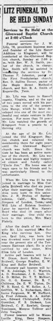
Although Litz Manor didn’t develop along Warpath Drive until 1929, the Joel Litz family had lived on the property since 1857. They moved from Russell County, Virginia. Joel Litz, the patriarch, is mentioned in an 1865 document as one of several who recommended that the president pardon of Charles Vance, a rebel commissioner, after the Civil War. At least three generations of the Litz family are in the Pyle Cemetery off Stagecoach Road in Preston Woods.
The obituary of John W. Litz gave an impressive account of his life, noting he “watched the growth of Kingsport from a prairie to a thriving city.” In fact, J. Fred Johnson, the father of Kingsport, was one of his pallbearers.

There are no schools or churches bearing the name “Litz Manor” any longer, but the City of Kingsport’s neighborhood map still refers to the area surrounding Fort Henry Drive & Warpath Drive (including Fort Henry Mall) as such.
Shelton Clark shared that Litz Manor was a very tight knit community. He mentioned that other lost places formerly named “Litz Manor” are Litz Manor Floral, 1417 Warpath Drive, Litz Manor Coal Yard, Litz Manor Furniture, and Litz Manor News Stand.
Litz Manor Methodist, now St. Matthew Methodist, was renamed during the depression as shared by Terry Ketron.

Leave a comment